A New Bridge Over San Anselmo Creek for Thanksgiving Weekend Walks
November 19, 2026
November 19, 2026
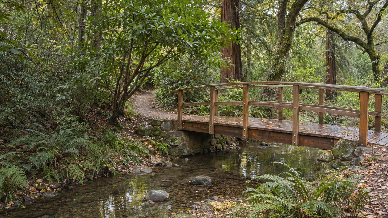
Until this fall, the trail up Cascade Canyon crossed San Anselmo Creek on rocks. As of Thanksgiving weekend, the upper crossing is a 60-foot weathered-steel truss with a deck of reclaimed redwood. On October 12, 2026, Marin County Parks posted that construction on the upper bridge and its connecting trail work was complete. The lower bridge, near the canyon entrance, is still a year away.
Something similar is happening at the other end of town. The Sorich Park Trail has been rebuilt, widened and opened to bikes. A second trail the Town of San Anselmo wants to add there is still being planned. At both edges of town the first piece of work is finished and the next piece is still to come, and the finished pieces are the ones you can walk over Thanksgiving weekend.
The county's project page explains why the bridges are going in. Visitors used to cross San Anselmo Creek at four low-water rock fords. When the creek runs high in the rainy season those crossings could injure people, and walking through them stirs up fine sediment that can harm the steelhead downstream. The county wrote its objectives plainly: provide "safe and sustainable year-round access" to Canyon Fire Road and the interior of the preserve, and remove the need to ford the creek at all.
The new crossing is bridge 2. The 2021 environmental plan places it about 1,000 feet upstream of where bridge 1 will go, carrying Canyon Trail over the creek. Both bridges are designed six feet wide. Bridge 2 is 60 feet long, and the downstream bridge will be 90.
The county's June 8 update scheduled the upper bridge for August through October 2026 and the lower bridge for August through October 2027, with all work done by October 2027. So this winter, and only this winter, one of the two crossings is built and the other is still in the creek. Cascade Falls is the canyon's main rainy-season draw, a 20-foot drop the county lists alongside shady canyon trails and creek reaches that run year-round. The same county page warns that trails get muddy in the rain.
The project had a long lead-up. The Marin Independent Journal reported in December 2023 that county supervisors had approved the environmental document and the project. In that article, Tom Boss of the Marin County Bicycle Coalition called it a "win-win for wildlife and visitors."
The finished canyon will be laid out differently, and knowing the plan explains the fencing and new signs you may see along the creek. Under the approved design, bridge 1 sits near the Cascade Canyon Fire Road entrance, 140 feet downstream of the first of the four rock fords. Its north end lands on Cascade Fire Road and its south end on Canyon Trail.
The rock fords will stay in the creek, but only so Marin County Open Space District crews and emergency vehicles can still drive across. The plan calls for detachable fencing to keep visitors off them. The project also retires two paths. The High Water Trail is to be decommissioned and restored, along with the Canyon Trail spur that connects to Cascade Fire Road, and the damaged stream banks along them will be rehabilitated.
Bikes also come into it. Once the work is done, the stretch of Canyon Trail between Cascade Canyon Fire Road and the south end of bridge 1 changes from hikers and horses only to multiuse. Chicanes in that stretch will slow riders down. The project summary adds new signage, a bike rack and other bicycle speed-control features.
At the north end of town, the county has finished the same kind of work. In its June 2026 updates bulletin, the Marin County Open Space District announced that the upgraded Sorich Park Trail was complete and open. Crews widened it to four feet, firmed up the surface, improved drainage and thinned small-diameter trees so people can see farther ahead. It is now multiuse, so cyclists now share it with hikers and horseback riders.
The route is short and connects three places. A February 2026 county notice describes a trail of roughly 1,650 feet running from Cemetery Fire Road through Sorich Park toward the Mission Pass Bike Path. The trailhead is inside Sorich Park, and the trail crosses into the Terra Linda/Sleepy Hollow Divide open space. Before the rebuild the trail was for hikers and horses only. If you remember it that way, expect to meet bikes now.
The second half belongs to the Town of San Anselmo, and it is a separate project. The Town is seeking approvals for a new connector, for hikers only, that would run from Sorich Park to Cemetery Fire Road across land owned by the Town and by Tamalpais Cemetery. The Town Manager's July 3, 2026 newsletter treats it as separate from the county's work and says planning is underway. Over Thanksgiving weekend, the trail you can walk at Sorich is the wider county trail with mixed traffic. A hikers-only route there is still in planning.
Neither project touches the three open spaces on San Anselmo's other edges. Each parks differently, and on a holiday weekend parking may decide where you go. Cascade's own county page warns that parking is limited to residential streets at the Cascade Drive gate and at the end of Canyon Road, and that weekends and holidays can be difficult.
Red Hill is the shortest walk from town. The signed trailhead is behind Westamerica Bank, Edo Grill and Walgreens, and you can park in the Red Hill Shopping Center or at the end of Shaw Drive. The out-and-back is three-quarters of a mile each way, with about 400 feet of climbing and views from the trail and the summit. A round trip takes about an hour. It is rated medium and kid-friendly, but it is too steep and narrow for a stroller. Of all the trails near town, Red Hill works best for an hour between the pie and the dishes.
Loma Alta is the biggest climb. From the San Anselmo side, start at the end of Glen Drive. From the west, use the large gravel pullout on Sir Francis Drake Boulevard just below the crest of White Hill, or park on the street. The summit is 1,592 feet, and the ridge and summit roads look out over the Bay. Sunrise Fire Road is extremely steep. Old Railroad Grade, along the lower edge of the preserve, is the easier option.
Terra Linda/Sleepy Hollow is where the Sorich trail ends up. You can get in at the end of Freitas Parkway, at the end of Wintergreen Terrace, or from Lucas Valley Road across from Mt. Muir Court and Mt. Lassen Drive, and parking is on the street at all of them. Terra Linda Ridge Fire Road looks toward Mount Tam and Big Rock Ridge. Eagle Rock Trail runs through woodland, with footbridges and outlooks. For more on the neighborhood at the bottom of the ridge, see our Terra Linda page.
Marin County Parks keeps a running alerts and closures page. It lists a temporary closure of the Mount Baldy Trail at Bald Hill for improvements. The preserve closures on that page were last updated September 28, 2026. It is worth a look before you drive to any trailhead over the long weekend, and especially before a Bald Hill loop.
If you'd rather walk with a group, the nearest scheduled outing is in Novato. One Tam's Indian Tree hike runs Sunday, November 29, 2026, from 9 a.m. to 2 p.m. It covers up to 6.5 miles and 1,300 feet of elevation change. Registration is required.
For a wider list of walks around the county, our Marin County hikes guide picks up beyond the Ross Valley. If your walk ends with lunch on the Avenue, our guide to everyday life in San Anselmo has ideas.
Projects like the Cascade bridges and the Sorich trail shape everyday life in the Ross Valley, and Team O'Brien keeps track of them across Marin. If you're curious how a trailhead around the corner affects what your San Anselmo home is worth, get your free home valuation or schedule a consultation with David and Deirdre.
Marin County Real Estate
Marin County Homeowners Associations
Novato Real Estate
Novato Real Estate Market
San Rafael Real Estate
San Rafael Real Estate Market
Marin County Hikes
Shafter Fire Road - Trail Head
At Team O’Brien, real estate isn’t just about buying and selling homes—it’s about helping you make the right move with confidence. Whether you’re buying, selling, or investing, we take the time to understand your goals and provide tailored solutions for success.